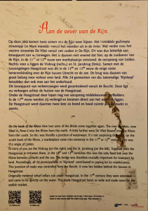
On the bank of the Rhine
Here two arms of the Rhine come together again. The river ‘De Mare’, now filled in, flowed into the Rhine from the north. A little further west De Vliet flowed in to the Rhine from the south. So this was literally a junction of waterways. It's not surprising that on the south bank of the Rhine, a marketplace came into existence in the 11th and 12th century this was the origin of Leiden.
in front of you are the Visbrug (on the right) and the St. Jansbrug (on the left). Together with the Hoogstraat in between them. In the 12th and 13th centuries this Was the only fixed link over the Rhine between Utrecht and the sea. The bridge was therefore crucially important for transport by land. Accordingly all 24 municipalities in ‘Rijnland' contributed to paying for its maintenance. This junction of roads was controlled from the Burcht. lt now lies hidden behind the houses in Hoogstraat.
Originally medieval wharf cellars run under Hoogstraat. In the 17th century they were extended and come to lie directly on the water. This made Hoogstraat twice as wide and made room for the seafish market.

